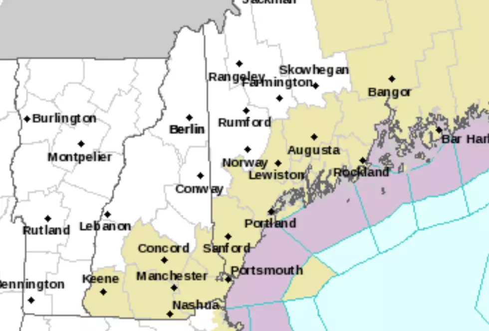
National Weather Service: Flood Watch & River Flooding Potential
The National Weather Service in Caribou posted a Flood Watch + expected rainfall and with advisories. As of 11:45 pm Saturday:
River level in Washburn dropped, a sign that the ice is releasing. THIS DOES NOT MEAN THE DANGER IS OVER! In fact, areas downstream from Washburn (Crouseville, Presque Isle) will likely see worsening conditions if the ice continues moving downstream! As of midnight, route 164 between Presque Isle and Washburn is now reportedly flooded just east of Crouseville on the Presque Isle side. As the ice releases from the Washburn ice jam, be alert for water rises between Washburn and Presque Isle along with ice chunks in the water.
National Weather Service Advisories:
* Additional rainfall of .5" to locally 1" can be expected across Northern and Eastern Maine through Sunday. Rain will be heavy at times this morning, with showers this afternoon that could be locally heavy. Also look out for fog through Sunday. Low visibility from the fog could make it hard to see floodwaters.
* New rain plus melting snow is leading to the high waters and flooding threat from streams and rivers. Have alternate routes ready and remember...Turn Around, Don't Drown!
* High freshwater river flow in addition to high tide Saturday and Sunday night could cause minor flooding in Bangor near high tide around midnight.
* Main stem rivers will crest in minor or moderate flood stages into early week. Follow forecast and current river levels at (note some gauges are currently affected by ice/ice jams).
More From