Weather Forecast: Aroostook County, Maine
Local Weather Forecast for Presque Isle and surrounding area with the hourly forecast, and a detailed look at the weather from the U.S. National Weather Service in Caribou, Maine.
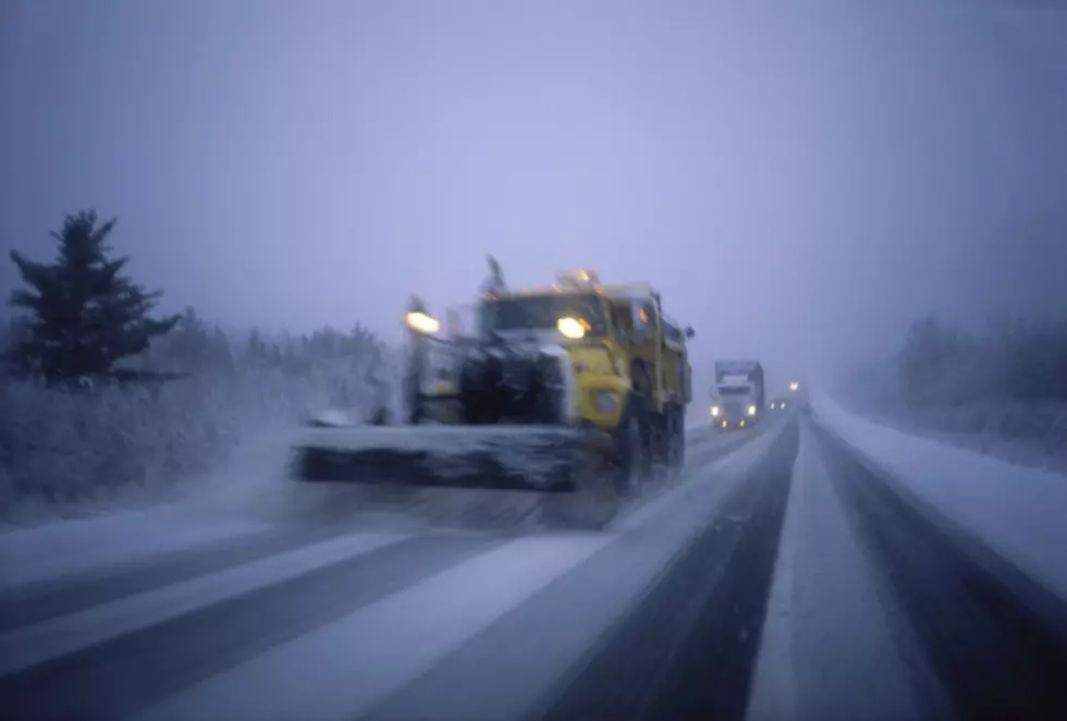
Forecasters say the biggest snow storm since early December is bearing down on northern Maine and New Brunswick. Snow is expected to be heavy throughout the day tomorrow and then mix with sleet and freezing rain tomorrow night. Gusty winds and blowing snow will likely make travel difficult. Total snow and sleet accumulation by the time the storm winds down early Wednesday should range from 6 to 12 inches. The only other major storm in our area this winter dumped about 14 inches of snow on Dec 5 & 6th.
TOWNSQUARE MEDIA WEATHER:
- Monday ~ Partly sunny. Highs around 23/-5 Celsius
- Monday Night ~ Clouding up with lows near 18/-8C.
- A Winter Storm Warning is posted Tuesday and Tuesday night
- Tuesday ~ Snow, accumulating 4 to 8 inches by the end of the day. Gusty winds & patchy blowing snow Highs around 27/-3C.
- Tuesday Night ~ Snow mixing with sleet and freezing rain.. Near steady temperature in the upper 20s. Diminishing winds after midnight. Another 2 to 4 inches of accumulation possible.
- Wednesday ~ Cloudy with a chance of snow showers or mixed precipitation. Highs around 33/+1
U.S. NATIONAL WEATHER SERVICE:
- Winter Storm Warning in effect from February 2, 07:00 AM EST until February 3, 07:00 AM EST
- Monday: Mostly sunny, with a high near 24. Wind chill values as low as -10. Calm wind becoming northeast around 5 mph in the afternoon.
- Monday Night: A chance of snow, mainly after 4am. Mostly cloudy, with a low around 18. Light northeast wind increasing to 5 to 9 mph in the evening. Chance of precipitation is 30%.
- Tuesday: Snow, mainly after 8am. Patchy blowing snow after 10am. High near 29. Northeast wind 13 to 18 mph, with gusts as high as 29 mph. Chance of precipitation is 100%. New snow accumulation of 4 to 8 inches possible.
- Tuesday Night: Snow and sleet before midnight, then snow, freezing rain, and sleet likely between midnight and 3am, then snow and freezing rain likely after 3am. Low around 28. North wind 10 to 15 mph. Chance of precipitation is 100%. New ice accumulation of less than a 0.1 of an inch possible. New snow and sleet accumulation of 2 to 4 inches possible.
- Wednesday: A chance of snow showers and freezing rain before noon, then a chance of rain and snow showers between noon and 3pm, then a chance of snow showers after 3pm. Cloudy, with a high near 33. North wind 6 to 9 mph. Chance of precipitation is 50%. New precipitation amounts of less than a tenth of an inch possible.
- Wednesday Night: A chance of snow showers. Cloudy, with a low around 26. North wind around 6 mph. Chance of precipitation is 40%.
- Thursday: A chance of snow showers, mainly before 9am. Mostly cloudy, with a high near 32. Northwest wind around 8 mph. Chance of precipitation is 30%.
- Thursday Night: Mostly cloudy, with a low around 18.
- Friday: A chance of snow, mainly after 3pm. Mostly cloudy, with a high near 34. Chance of precipitation is 40%.
- Friday Night: Snow likely, mainly after 7pm. Cloudy, with a low around 28. Chance of precipitation is 60%.
- Saturday: A chance of rain and snow showers. Mostly cloudy, with a high near 35. Chance of precipitation is 50%.
- Saturday Night: A slight chance of snow showers. Mostly cloudy, with a low around 23. Chance of precipitation is 20%.
- Sunday: A slight chance of snow. Mostly cloudy, with a high near 33. Chance of precipitation is 20%.
The interactive radar has more regional weather. Our app gives you weather alerts & keeps you updated. Free app download.
We have more northern Maine weather info from the U.S. National Weather Service in Caribou.
Stream the station online for the weather. Use the app & listen on the radio.
WEATHER REPORT:
The “Weather Report” is an editorial about the weather. It’s how many of us talk about a storm beyond the forecast itself.
Good thing we’ve been getting ready - in a general sense - for a winter storm. Gas filled up in the car, warm clothes - just in case, and an emergency supply of water and food - just in case.
If you have a propane tank, make sure you inspect the icicles coming off the roof as they melt. If you have a huge stalactite-like icicle, make sure you catch it early to knock it down.
We have had a very mild January with our last significant snowfall in early December. As Mainers, we’ve been down this road once or twice before. But every storm brings preparedness and forethought.
If the power goes out, make sure you have food to eat that doesn’t have to go in the microwave or something electric.
Candles will be helpful too - just to bring some light if we are without electricity for any period of time. Not a lot you can do about heat if you don’t have a wood fireplace or generator. Dress warm and bundle up until the heat comes back on is all you can do.
If you have a commute, you’re already planning on leaving early. Keep an eye out for the plows and help a neighbor out if you can.

LOOK: Here are copycat recipes from 20 of the most popular fast food restaurants in America
More From